
Spatial Data & Document Portal — YMAC
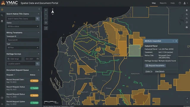
Django web portal, PostgreSQL/PostGIS databases, GeoServer, and FME automation managing 12+ years of historical spatial records and legal tenure datasets.
- Historical Records
- 12+ Years Tenure & Heritage
- Web Framework
- Django / Python
- Spatial Middleware
- GeoServer & FME Server
- django
- python
- postgresql
- postgis
- geoserver
- fme-server
- enterprise-gis
Evidence
Client-confidential — walkthrough available on request
Overview
Yamatji Marlpa Aboriginal Corporation (YMAC) is the Native Title Representative Body for the Traditional Owners of the Pilbara, Midwest, and Gascoyne regions of Western Australia. The organisation handles massive volumes of sensitive legal, tenure, and anthropological records—including mining tenements, pastoral leases, heritage survey boundaries, and historical anthropological site notes spanning more than a decade of research.
To eliminate manual bottlenecks and fragmented file shares, I developed and maintained a centralised internal Django-based spatial data and document portal. The system allowed internal legal teams, anthropologists, and spatial analysts to discover, request, and retrieve historical documents and spatial boundary datasets securely.
System Architecture
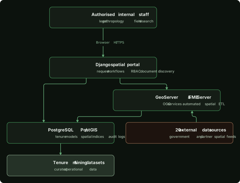
The portal integrated a Python web application with enterprise geospatial data stores and automated spatial ETL servers:
Engineering Contributions
1. Django Application & Document Discovery
- Built and maintained an internal web portal using Django and Python, providing role-based access control (RBAC) to ensure sensitive Native Title records were accessible only to authorised project teams.
- Implemented spatial and attribute search interfaces allowing staff to query legal files, survey reports, and spatial layers by claim area, tenement ID, or date.
- Built a streamlined request queue where legal teams could lodge cartographic and research requests, tracking progress through structured administrative workflows.
2. Relational & Spatial Database Engineering
- Managed the central PostgreSQL/PostGIS database, designing spatial schemas to store complex multi-polygon native title boundaries, historical pastoral leases, and mineral exploration licences across Western Australia.
- Maintained strict topological validation and spatial indexing (
GiST) across high-complexity boundary datasets containing tens of thousands of vertices.
3. Geospatial Automation & Data Infrastructure
- Installed and administered GeoServer and FME Server instances to serve standard OGC web services (WMS/WFS) across internal desktop GIS installations (QGIS/ArcGIS).
- Engineered automated ETL scripts with FME and Python to pull, validate, and refresh spatial datasets from over 20 external sources (including the Western Australian Department of Mines, Industry Regulation and Safety).