
Urban Tree Canopy, Change & Height Analysis
Tree-canopy extent, change, height and greening-prioritisation work across five Tasmanian councils, with inputs and methods scoped to each project.
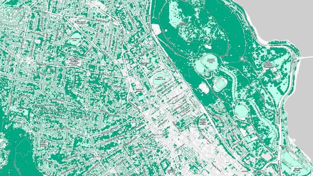
- Council Coverage
- 5 Tasmanian Councils
- Councils
- Brighton, Clarence, Devonport, Hobart & Kingborough
- Hobart Public Study
- Satellite Canopy Change, 2017–2022
- Other Project Outputs
- Canopy Extent, Height & Prioritisation
- geoai
- remote-sensing
- tree-canopy
- change-detection
- python
- qgis
Evidence
Overview
Across five Tasmanian councils—Brighton, Clarence, Devonport, Hobart and Kingborough—I worked on tree-canopy mapping and analysis at Geoneon. The projects covered canopy extent, temporal change, canopy height and greening prioritisation. Inputs and outputs varied by council; these were separate deliveries rather than one standard workflow applied everywhere.
Hobart: Satellite Canopy Mapping & Change
Geoneon’s public Hobart case study describes deep-learning classification of high-resolution satellite imagery and comparison of canopy cover between 2017 and 2022. Those dates describe the imagery comparison, rather than my personal contribution period.
My delivery record covers imagery and council-data preparation, canopy inference and post-processing, spatial summaries, quality checks and reporting. The public Hobart evidence supports canopy extent and change analysis; it does not establish a LiDAR-derived height model or per-tree height attribution for this delivery.
Later Council Deliveries
The retained delivery records distinguish the following work:
| Council | Documented scope |
|---|---|
| Clarence | High-resolution imagery and council GIS preparation, canopy inference, classification cleanup, spatial summaries and reporting in January–March 2025. |
| Brighton | Multi-date canopy mapping, change analysis, canopy-height analysis and contextual prioritisation in October–November 2025. |
| Devonport | Aerial imagery and council-context layers, canopy mapping and greening prioritisation around public and transport assets in November–December 2025. |
| Kingborough | Tree-canopy delivery, confirmed from my first-hand project history on 1 October 2026. Specific inputs, methods and delivery dates are not separately documented here. |
Brighton’s record supports canopy-height work, but does not specify the elevation source or height-model construction. It should not be read as evidence that all five councils used airborne LiDAR, nDSM subtraction, the same segmentation architecture or the same height thresholds.
Data Engineering & Council Handover
The recurring work involved preparing imagery and study boundaries, checking spatial consistency, running and reviewing canopy outputs, and producing council-level summaries, maps and reports. Devonport’s prioritisation work brought canopy results together with buildings, cadastral and land-use data, and community assets.
Public evidence linked above describes Hobart. The other council scopes come from retained delivery records and first-hand project confirmation, rather than from the Hobart publication.