
Pacific Vegetation Monitoring & Laos Population Exposure
Two separate initiatives: satellite vegetation-height validation in the Pacific, and building-level population allocation and open-data training in Laos.
- Pacific Operational Sensor
- Sentinel-2 Optical Imagery
- Pacific Product
- 10 m Mean Vegetation Height
- GEDI Reference Footprint
- ~25 m Diameter
- Laos Population Model
- Mass-Preserving Building Allocation
- earth-observation
- nasa-gedi
- lidar-validation
- dasymetric-mapping
- stac
- sentinel-2
- python
Evidence
Overview
This case covers two separate initiatives at Geoneon: Pacific vegetation-height validation, and Laos population exposure and open-data training. They addressed different questions and used different data pipelines.
Pacific: Vegetation Monitoring & GEDI Validation
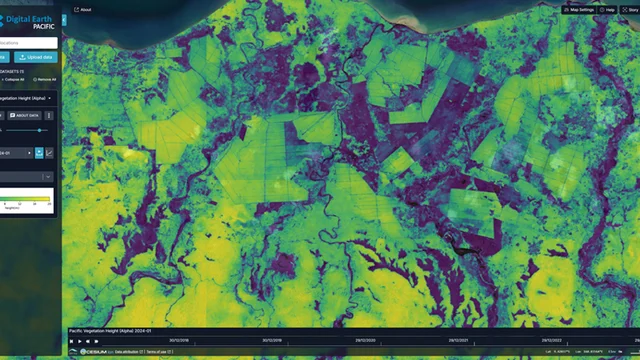
Geoneon’s published Pacific analysis describes Sentinel-2-based estimates of mean vegetation height at 10 m resolution, with quarterly products covering 2020–2025. That range is product coverage, not the duration of my work on the initiative. Mean vegetation height also differs from the height of an individual tree or the tallest point in a canopy.
My retained delivery record covers comparisons between satellite height products and GEDI observations, including error and bias statistics across temporal composites. The comparison needed to account for differences in spatial support and canopy definitions: a satellite pixel and a GEDI observation do not sample the same area or measure identical properties.
GEDI’s laser footprints are approximately 25 m in diameter, as documented in the mission’s instrument specifications. I used those observations as reference samples when assessing the satellite-derived products.
Related Imagery Preparation
My records also describe optical and radar imagery preparation through cloud services and STAC, including Sentinel-1 and Sentinel-2 inputs, cloud and water filtering, and inference quality checks. That preparation work does not establish Sentinel-1 as an input to the published operational height product. The product description and sensor metric above follow the publicly documented Sentinel-2 workflow.
Laos: Building-Level Population Exposure
This initiative allocated administrative population totals to building footprints for flood-exposure screening. It was independent of the Pacific vegetation-monitoring workflow.
- Population allocation: Prepared building candidates, administrative boundaries and population inputs, then developed allocation workflows that preserved the source totals.
- Spatial checks: Checked boundary consistency and allocation results before producing building-level exposure layers.
- Flood screening: Prepared population outputs for comparison with flood-hazard information, with quality checks and documented assumptions.
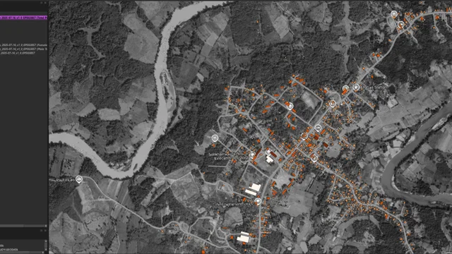 Retained project screenshot: building-level population allocation along river corridors in Laos.
Open-Data Training
The delivery records document open-data training in August 2025 and dasymetric modelling training in September 2025. I prepared exercises covering data acquisition, elevation and building inputs, spatial consistency, population allocation and reproducible analysis. Training also addressed formats, data quality and interoperability.
Evidence Scope
The public links in the evidence block support the Pacific product and GEDI instrument. The Laos scope is supported separately by retained delivery records and the QGIS screenshot above. No independent public Laos project report is linked here; the Pacific article should not be used as evidence of the Laos delivery.